Rottnest Island Beaches And Swimming: Every Bay, Snorkel Trail And Water Rule
Rottnest Island packs 63 beaches and 20 bays into an island 11 km long, and almost all of the water play happens in a handful of sheltered corners. Here is how the bays differ, where the snorkel trails run and what rules apply in the water.
Short answer
Rottnest Island has 63 beaches and 20 bays, with swimming possible year-round, though many swimmers wear wetsuits in winter. The sheltered bays near the settlement suit families, Parker Point and Little Salmon Bay hold the snorkel trails, and five marine sanctuary zones carry their own fishing rules. A 5 knot speed limit applies in most bays.
Rottnest Island, known to Whadjuk Noongar people as Wadjemup, holds 63 beaches and 20 bays inside 19 square kilometres of island, which spreads visitors out across a string of bays instead of one busy strip of sand. The island sits 19 km from Fremantle Port, 22 km from Hillarys Boat Harbour and 33 km from Perth, close enough that a swim before lunch is a normal day-trip plan. The water is the reason most people come: the reserve holds roughly 400 fish species and 20 coral species, far more tropical life than latitude alone would suggest, thanks to the warm Leeuwin Current that sweeps down the Western Australian coast. This guide walks through the bays that actually get swum in, the two marked snorkel trails, the sanctuary zone rules that differ bay by bay, and the honest water-safety picture. It also points to the products that get you onto, or under, the water with a guide, from the Rottnest Snorkel boat trips to the catamaran snorkel and sail. For planning the crossing itself, the Hillarys ferry and bike guide covers the fastest mainland departure point.
How Many Beaches Does Rottnest Island Have?
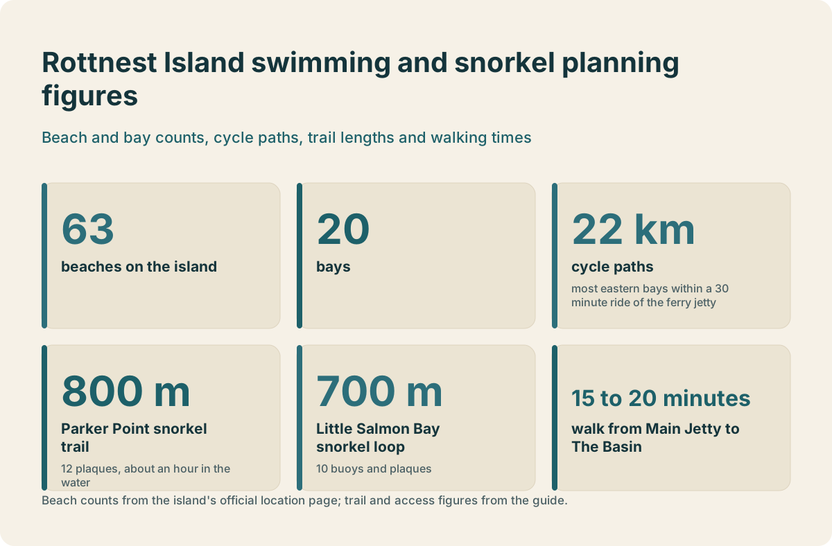
The official count is 63 beaches across 20 bays on an island just 11 km long and 4.5 km wide, with the highest point only 45 m above sea level. Almost all visitor swimming happens in a small set of sheltered southern and eastern bays within easy reach of the Thomson Bay settlement. The rest ranges from open ocean frontage on the west coast to quiet pockets that see very few people on any given day.
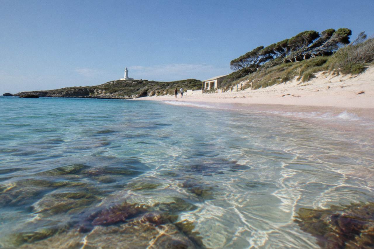
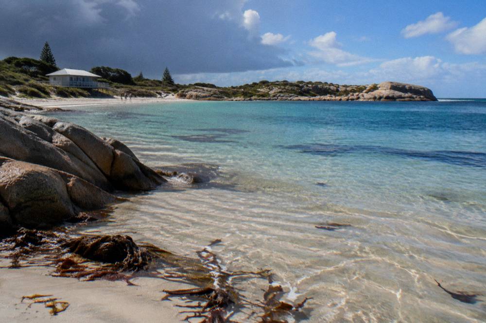
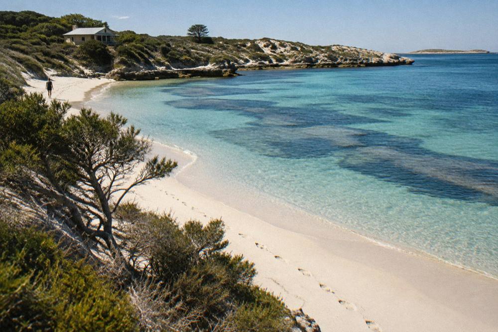
That number comes straight from the island's official location page, and it is worth taking seriously as a planning fact: no day trip covers 63 beaches, and no week-long stay needs to. The practical geography is simpler. Thomson Bay wraps around the main settlement and the Main Jetty, where every ferry arrives. Geordie Bay and Longreach Bay sit a short ride or walk north of the settlement, both shallow, sandy and calm in typical summer conditions. Further around, The Basin, Little Salmon Bay and Parker Point face south and east, catching the sheltered side of the prevailing sea breeze, which is exactly why the two marked snorkel trails were placed there. The west coast, from Cathedral Rocks out to West End, is a different island entirely: exposed reef, bigger swell and the furthest point from help, better appreciated from a boat or a lookout than from the water.
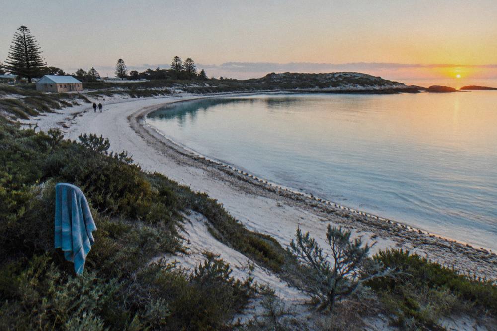
Because the island is vehicle-restricted, the water you swim in is usually the water you can walk, ride or bus to. The 22 km of cycle paths put most of the eastern bays within a 30 minute ride of the ferry jetty, and the Island Explorer hop-on hop-off bus stops at key points including stop 5 near the Parker Point trail. Depth varies as much as exposure. The Basin is famously shallow, while the bays off the settlement shelve gently over sand. The general swim season runs September to April, when the water is warmest and the weather most reliable, but nothing formally closes in winter; the official position is simply that swimming is possible year-round and many people wear wetsuits through the colder months. Anyone building a first visit around the water should start with the day trips from Perth overview before drilling into individual bays.
Which Rottnest Beaches Are Best For Swimming?
For calm, family-friendly swimming, the standouts are The Basin, Little Salmon Bay, Geordie Bay, Longreach Bay and the settlement beach at Thomson Bay, all on the sheltered eastern and southern side of the island. The Basin is the best known, a shallow reef-protected pool that has become the island's signature swim. None of these bays involves more than a modest ride or walk from the ferry arrival point.
The Basin sits about 15 to 20 minutes on foot from the Main Jetty and is the bay most first-time visitors set out for. It is shallow, partly enclosed by reef, and holds fish and coral close enough to the surface that a mask turns a swim into a snorkel without any effort. Little Salmon Bay, further south, is quieter and is one end of a marked snorkel trail, so it suits swimmers who like something to look at. Geordie Bay and Longreach Bay, north of the settlement, are the sandy, shallow, low-stress options, good for children and for anyone who wants a straightforward swim rather than a reef experience. The beach directly off Thomson Bay, right by the settlement, is the fallback when time is short: you can be in the water within minutes of stepping off the ferry.
The table below groups the main swimmable bays by what they are actually like, using only descriptions consistent with the official island pages.
| Bay | Side of island | Character | Best suited to |
|---|---|---|---|
| The Basin | South-east | Shallow, reef-sheltered swim spot | The classic first swim, families, casual snorkelling |
| Little Salmon Bay | South | Calmer bay, start of a marked snorkel trail | Swimmers who want fish and trail markers |
| Geordie Bay | North-east | Sandy, gently shelving | Children, easy swimming, picnics |
| Longreach Bay | North-east | Shallow and sandy, near the settlement walk | Relaxed swims, short visits |
| Thomson Bay settlement beach | East | Right beside the jetty and settlement | Swimming straight off the ferry |
| Parker Point | South-east | Snorkel trail bay inside a sanctuary zone | Snorkelling over coral, trail swimming |
Access shapes the choice as much as the water does. Cyclists reach all of these bays easily on the flat-to-gentle eastern paths, which is one reason the ferry and bike packages are the default way to see the island's water: the Rottnest Fast Ferries bike day from Hillarys runs from A$124 per person with ferry, bike and the island admission fee included, rated 4.7 from 2,941 reviews, and the Rottnest Express bike day from Fremantle is a similar product from A$127. Swimmers who would rather not ride can use the Island Explorer bus, and the two marked trails both sit on or near its route. If swimming rather than scenery is the point of the day, pick one bay in the morning before the sea breeze picks up and a second on the way back to the ferry, rather than attempting to tour the whole coastline.
Where Can You Snorkel On Rottnest Island?
The two marked snorkel trails are at Parker Point, about 800 m long with 12 interpretive underwater plaques, and Little Salmon Bay, a roughly 700 m loop marked by 10 buoys and plaques. The Basin works as an easy unstructured snorkel, and guided options include the Rottnest Snorkel boat trips and a catamaran snorkel and sail, both departing from Thomson Bay.
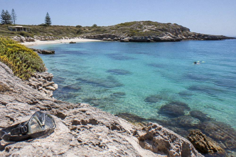
Parker Point is the headline. It sits in the island's south-east corner, inside a marine sanctuary zone where the pink pocillopora coral grows, and the trail's 12 seabed plaques turn the swim into a self-guided tour. The official guidance is to allow about an hour in the water, and the bay is roughly 17 minutes by bike from Thomson Bay, with the Island Explorer bus stopping at stop 5 nearby. Little Salmon Bay's trail is shorter, a 700 m loop with 10 markers describing the marine life, and it sits close enough to The Basin that the two can be combined in one outing. Both trails are promoted as available on the official site, and both reward arriving early: the plaques are easiest to follow in calm, bright conditions, and the marine life is more active before the day's boat traffic builds.
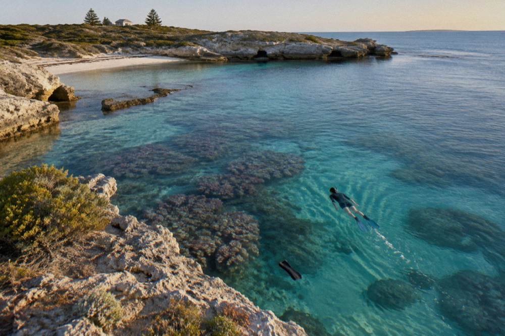
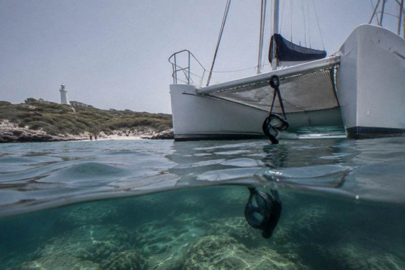
For snorkellers who want a guide, gear and deeper water than the trails offer, the boat products fill the gap. The guided snorkel boat experience run by Rottnest Snorkel is a 3 hour trip from Thomson Bay from A$239 per person, rated 4.5 from 51 reviews, with the island admission fee included and free cancellation; its listing notes small in-water groups with a guide. The half-day catamaran snorkel and sail from Charter 1, from A$185 per person and rated 4.8 from 33 reviews, blends trail-style snorkelling with kayaks and stand-up paddleboards off a sailing catamaran. Gear hire on the island itself is covered in detail in the snorkelling tours and spots guide, and the can you hire snorkels at Rottnest post answers the most common equipment question directly.
What Are The Marine Sanctuary Zone Rules?
Rottnest's waters are divided into five marine sanctuary zones: Kingston in Thomson Bay, Parker Point, Green Island, Armstrong Bay and West End Demersal, and fishing or collecting is prohibited or restricted inside them, with the rules differing by zone. A 5 knot speed limit applies in most bays, and there are no designated water-ski areas anywhere in the Marine Reserve.
The five zones each protect something specific, and the names alone tell most of the story. Kingston, in Thomson Bay right by the settlement, protects four shipwrecks. Parker Point protects the pink coral that makes its snorkel trail special. Green Island is a habitat for male Australian sea lions. Armstrong Bay protects seagrass meadows, and West End Demersal protects bottom-dwelling species including western rock lobster and dhufish. The practical takeaway for visitors is simple: treat the whole reserve as look but do not take, and check the official sanctuary zones page before fishing anywhere, because the boundaries are not always obvious from the beach. Fishers who want a legal line in the water should work from the detailed zone maps rather than guessing.
| Sanctuary zone | Location | What it protects | Visitor note |
|---|---|---|---|
| Kingston | Thomson Bay | Four shipwrecks | Wreck snorkelling near the settlement |
| Parker Point | South-east | Pink pocillopora coral | Snorkel trail bay, no take |
| Green Island | North-east | Male Australian sea lion habitat | Give hauled-out seals wide berth |
| Armstrong Bay | Western side | Seagrass meadows | Anchoring and take restrictions |
| West End Demersal | West End | Rock lobster, dhufish | Deep-water zone off the exposed coast |
The same waters carry the 5 knot limit in most bays, which matters to swimmers because it keeps boat traffic slow and predictable close to shore. There are no designated water-ski areas in the Marine Reserve at all, so the bays stay relatively quiet compared with a mainland boating estuary. The reserve as a whole holds about 400 fish species and 20 coral species, which is the honest headline number: this is a temperate island with genuinely tropical character, and the sanctuary zones are the reason that character has survived decades of visitation. The infographic below summarises the zone structure at a glance. The rest of the planning pages sit on Rottnest Island Tours.
Is It Safe To Swim At Rottnest Island?
Swimming at Rottnest is broadly regarded as safe in the sheltered bays, which are shallow, calm in normal conditions and free of the hazards that come with open surf beaches, but no beach on the island carries a verified safety rating and none should be treated as patrolled in the sense a metropolitan beach is. The honest guidance is qualitative: swim the sheltered bays, respect the conditions on the day, and follow the official island advice.
What can be said with confidence is factual rather than statistical. The popular swimming bays face north and east, away from the open Indian Ocean swell, and they are shallow enough that strong swimming is rarely required. Conditions change: the sea breeze that arrives most summer afternoons can whip up chop and push inflatable toys offshore, and winter storms reshape what a calm-looking bay feels like. The island's own practical-tips guidance is the right starting point, and the official beaches and water activities pages describe each spot's character without promising safety. Common sense rules apply everywhere: snorkel with a buddy, check the water before entering at an unfamiliar bay, avoid swimming at dawn or dusk in remote corners, and keep children within arm's reach at The Basin, where the reef edge drops away unexpectedly for a shallow bay.
Guided water products remove much of the judgement call. The catamaran snorkel and sail operates with crew on the water and gear provided, and the wildlife adventure cruise that pairs a Rottnest Express ferry with an eco boat ride, from A$164 per person and rated 4.5 from 244 reviews, keeps swimmers and sightseers in a supervised setting. Neither replaces personal caution, but both put experienced local eyes on the conditions, which is worth something on a day when the forecast is marginal. For the full picture on seasons and conditions, see the weather and best time to visit guide.
The other side of the safety question is the water rules that exist to protect the marine life rather than the swimmer. Feeding or touching wildlife, including in the water, sits under the same enforcement regime as the quokka rules on land: deliberate interference with wildlife can draw an on-the-spot fine and potential prosecution with fines up to A$10,000. In practice this means no chasing fish, no standing on coral and no touching the sea lions if one appears near Green Island, however curious it seems.
When Is The Best Time Of Year To Swim At Rottnest?
The warm-water season runs September to April, with summer the busiest and warmest period, but swimming is possible year-round and many winter swimmers wear wetsuits. Winter, June to August, suits hiking and wildlife viewing, and whale watching runs mainly August to December, with sightings sometimes from June and July.
The island's climate is mild by Australian standards: summer averages around 26 C and winter around 18 C, with most rain falling in winter. Water temperature follows the same curve, and the Leeuwin Current keeps the island's water warmer than its latitude suggests, which is why coral thrives here at all. For pure swimming comfort, the stretch from late spring through early autumn is the obvious window, and it coincides with the busiest ferry days, so the trade-off is warm water against crowds at The Basin and Little Salmon Bay. Shoulder months split the difference nicely: the water is still swimmable, the bike paths and snorkel trails are quieter, and ferry fares are less pressured.
| Season | Months | Conditions | What the water suits |
|---|---|---|---|
| Summer | Dec to Feb | Warmest water and air, busiest ferries | Peak swimming and snorkelling, arrive early |
| Warm-water season | Sept to Apr | Reliable warm water, spring crowds building | Both snorkel trails at their best |
| Shoulder | Apr to May, Sept | Milder days, quieter bays | Comfortable swimming with fewer people |
| Winter | Jun to Aug | Coolest water, most rain, wetsuits common | Hiking and wildlife, brisk swims for the prepared |
| Whale season | Aug to Dec | Humpbacks passing, sometimes from Jun and Jul | Ferry and lookout whale watching |
Winter has its own case. The official guidance is that winter suits hiking and wildlife, and the Wadjemup Bidi walking trails are at their best when the summer sun is not bearing down. Swimmers who brave the cold get bays almost to themselves, and a wetsuit extends the season comfortably. One seasonal note applies to the water products: the Luxe Island Seafood Cruise, from A$395 per person and rated 4.9 from 56 reviews, states on its listing that it does not run in winter, so anyone planning a cold-month visit around a boat product should check the listing for the operator's season. Whales pass the island mainly from August to December, and while no sighting is ever promised, the chance of spotting humpbacks from a ferry or a lookout is a genuine spring bonus. Costs for the whole day are broken down in how much does a day trip to Rottnest cost.
Do You Need A Boat Tour To Enjoy Rottnest's Water?
No, the best of Rottnest's water is reachable from the shore: The Basin, both snorkel trails and the settlement beaches need nothing but a mask and a towel, and a ferry and bike package covers the transport and the wheels. A boat tour adds deeper reef, guided snorkelling and wildlife sightings the shore cannot reach, which is why many visitors do one beach morning and one boat afternoon.
The self-directed version is genuinely good. A ferry and bike day puts you on the island with wheels, the island admission fee already collected inside the fare, and the cycle paths connect The Basin, Little Salmon Bay and Parker Point in an easy loop. Snorkel gear can be hired on the island, and the trails are designed for independent swimmers, with plaques and buoys doing the interpretation a guide would do elsewhere. What the shore cannot deliver is the off-shore experience: deeper wreck and reef sites, the seals at Cathedral Rocks, a circumnavigation of the West End cliffs, or snorkelling with a crew watching the conditions. That is the gap the wildlife adventure cruise fills, pairing the ferry from Perth or Fremantle with an eco cruise around the island from A$164 per person.
The choice mostly comes down to time. A single day trip splits naturally into a morning at one bay and an afternoon on the water, and the is one day enough for Rottnest question is worth reading before committing. Two-day visitors, especially in peak summer, can afford a full beach day plus a boat product without rushing either. However the day is built, the water is the point: 63 beaches, 20 bays and a marine reserve that rewards both the swimmer who never leaves The Basin and the snorkeller who rides out to the reef with a guide.
Common Questions About Rottnest Island Beaches And Swimming
How many beaches does Rottnest Island have?
The official count is 63 beaches across 20 bays, on an island 11 km long and 4.5 km wide. Almost all visitor swimming happens in the sheltered bays on the eastern and southern side, close to the Thomson Bay settlement.
Can you swim at Rottnest Island all year?
Yes. Swimming is possible year-round, with the warm-water season running September to April. Many winter swimmers wear wetsuits, as the water cools through June to August even though air temperatures stay mild, averaging around 18 C.
Where are the snorkel trails at Rottnest?
The Parker Point Snorkel Trail runs about 800 m with 12 interpretive underwater plaques and needs about an hour. The Little Salmon Bay trail is a roughly 700 m loop marked by 10 buoys and plaques. Both are on the sheltered south-eastern side of the island.
Can you fish at Rottnest Island?
Fishing rules differ by zone. The island's waters include five marine sanctuary zones, at Kingston, Parker Point, Green Island, Armstrong Bay and West End Demersal, where fishing or collecting is prohibited or restricted. Check the official sanctuary zones page before fishing anywhere around the island.
What is the best beach for swimming at Rottnest?
The Basin is the best known swim, a shallow reef-sheltered spot a short walk from the Main Jetty. Geordie Bay and Longreach Bay are sandier and gentler, suiting families, while Little Salmon Bay combines a calm swim with the snorkel trail.
Are there boat speed limits in the bays?
Yes. A 5 knot speed limit applies in most bays of the Rottnest Island Marine Reserve, and there are no designated water-ski areas anywhere in the reserve, which keeps the swimming bays relatively quiet.